The Weather and Climate in Brazil
Due to its unique continental dimensions, Brazil possesses a wide variety of climates, influenced by its geographical configuration, its significant coastline, its relief, and the dynamics of the masses of air on its territory. This last factor is perhaps of the greatest importance, because it acts directly on the temperatures in the different areas of the nation. To give you a clearer picture with regard to the different climates present in Brazil, below we will briefly define the various weather patterns present in the country, and describe the climates you can expect to encounter in each of Brazil’s five climatic regions.
Climate of Brazil: Brazil’s Climate Classifications
The climate in a given area of Brazil is influenced by several factors, including temperature, rainfall, atmospheric humidity, winds and atmospheric pressure. These factors are in turn conditioned by factors such as altitude, latitude, relief characteristics, vegetation and continentality.
According to the climate classification system developed by Arthur Strahler, there are five primary climates present in Brazil. These include:
- Equatorial Climate. The humid equatorial climate is present in Northern and Central Brazil, an area which includes Amazonia. This particular climate is caused by the convergence of the trade winds.
- Tropical Climate. The tropical climate, which is alternately humid and dry depending on the season, can be found in the greater part of the central area of Brazil and along the coast of the middle-north.
- Semi-Arid Climate. The semi-arid climate of Brazil can be defined as a tropical climate that tends to be dry due to the irregularity of the action of the air masses in the region. In Brazil, this type of climate can be found in the hinterlands of the northeast and in the medium valley of the river São Francisco.
- Oceanic Climate. An oceanic climate is a coastal humid climate exposed to the marine tropical air masses. Brazil’s oceanic climate is dominant on the narrow strips of coastline in the eastern and northeastern sections of the country.
- Sub-Tropical Climate. The humid sub-tropical climate of the orient and subtropical coasts is dominated mainly by marine tropical air masses. In Brazil, the sub-tropical climate is dominant in the southern portion of the country.
Equatorial Climate
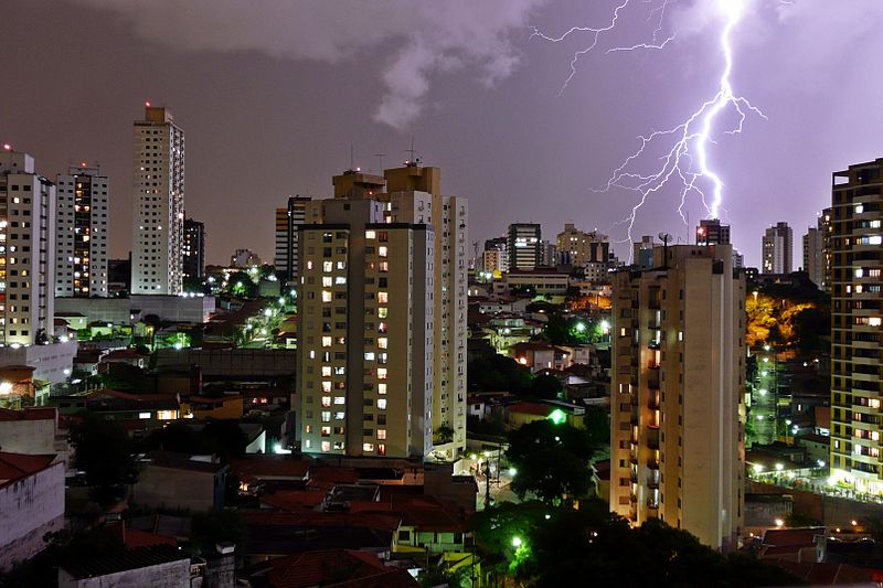 Thunderstorm in Sao PauloAn equatorial climate is usually one in which rainforests can be found because of the perpetual humidity in the region and precipitation. An equatorial climate has no winter season to speak of, and no period in which it is particularly dry. Rainfall is usually heavy and frequent throughout the year, yielding the dense luscious vegetation associated with rainforests. Night time temperatures may drop significantly from those during the day. However, daily temperatures are fairly alike as equatorial zones typically lie on the equator, placing them in the same line of latitude and, therefore, along the same pressure belt. Due to overcast skies with predominate in these regions, the daily high temperatures rarely exceed 33 degrees Celsius and are usually at a comfortable temperature between 25 and 28 degrees.
Tropical Climate
As the name suggests, a tropical climate is found exclusively in the tropics. The temperatures associated with this type of climate are fairly consistent year round, with the only distinguishing characteristic of the different seasons being the amount of rainfall they bring. In areas of rainforests, such as in Brazil, the average rainfall is at least 2.4 inches per year. To qualify as a tropical climate zone, an area must have an average temperature of over 18 degrees Celsius throughout the year.
Semi-Arid Climate
Areas with a semi-arid climate receive less rainfall than they actually need to make up for evaporation, but not so much less that the area becomes a desert. In other words, these zones are in between a desert and humid forest climate. In semi-arid zones, the vegetation includes hardy shrubs and grasses, rather than trees. There are “Hot semi-arid climates” and “cold semi-arid climates,” each with their own unique traits based on the variances in the average annual temperature.
Oceanic Climate
An oceanic climate, also called a maritime or highland tropical climate, can be found along the coast of Brazil. It is characterized by cool summers and warm winters, although the annual temperature does not vary by significant amounts. Rain is fairly standard throughout the year in an oceanic climate. To qualify as an oceanic climate zone, the region must have an annual mean temperature of not lower than 18 degrees Celsius.
Subtropical Climate
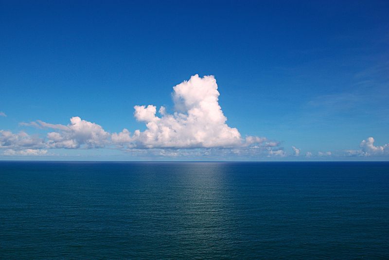 Clouds over the oceanA subtropical zone refers to the areas that are just outside of the formal tropical climate zones. Temperatures in these regions are hot, but not quite as hot and humid as in the tropical areas. Winters are fairly mild to cool, but rarely cold enough for snow or frost. In brazil, the subtropical zone experiences various levels of rainfall, depending on the region’s elevation above sea level.
Climate of Brazil: Weather Patterns According to Region
Great variance in temperatures and precipitation occur within Brazil. In general, the coastal cities can get very hot, while those regions on the plateaus usually enjoy milder temperatures and conditions. Northeast Brazil is the driest section of the country, yielding limited vegetation, while the basin of the Amazon River experiences the highest amount of rainfall and therefore produces a wide array of natural flora.
Northern Brazil
The northern region of Brazil includes a great part of the Amazon Basin and thus represents the largest extension of hot and humid forests on earth. The area is cut by Ecuador and is characterized by low altitudes, between 0 and 200 meters above sea level. In terms of temperature, the climate in the north is very hot, with annual average temperatures ranging from 24 to 26 degrees Celsius.
The rainy period of the year in northern Brazil occurs in the summer and fall months. The exception to this is Roraima and the northern part of the Amazonas, where the maximum pluviometric indexes occur in winter, due to the influence of the climatic conditions of the Northern Hemisphere.
Northeast Brazil
The climate patterns in the northeast stretches of Brazil are a bit complicated, and the four systems of circulation that influence the region are “denominated Systems of Disturbed Currents of South, North, East and West.”
The currents of the south are represented by polar air masses that reach the coastal areas of Brazil (until south of Bahia) in the spring and summer months, bringing frontal and back-frontal rains. In the winter, the polar masses reach even the coast of Pernambuco, Brazil, while the hinterland regions remain under the influence of the tropical air masses.
The currents of the north produce rain from the summer through the fall months even in Pernambuco, in the vicinity of the Raso da Catarina. On the other hand, the disturbed currents of the east are more frequent in the winter and they usually produce large amounts of rainfall in the coastal regions, although they rarely reach the higher elevations, such as Chapada Diamantina, at 1200 meters above sea level. Finally, the currents of the west tend to occur from the end of spring to the beginning of fall.
Temperatures in Brazil’s northeast region tend to be high, averaging between 20 and 28 degrees Celsius. Maximum temperatures of roughly 40 degrees Celsius have been experienced in the south of Maranhao and Piaui. The winter months, mainly in June and July, produce low temperatures between 12 and 16 degrees Celsius in the coastal regions. The plateau regions, however, tend to experience even lower temperatures—as low as 1 degree Celsius at the highest elevations.
Southeast Brazil
The position of latitude in the southeast of Brazil, along with the uneven topography and the influence of the current systems all play a role in the region’s climate, a climate that is very diverse in terms of temperature.
The average temperature in the southeast of Brazil, along the border between Sao Paulo and Parana, ranges from 20 to 24 degrees Celsius. In the elevated areas of the region, such as the Serra do Espinhaço, Serra da Mantiqueira and Serra do Mar, the average temperature can be drop to 18 degrees Celsius.
During the summer months, particularly in the month of January, the normal average temperature is between 30 and 32 degrees Celsius in the valleys of the rivers São Francisco and Jequitinhonha, in the Zona da Mata (Zone of the Forest) of Minas Gerais, in the coastal lowlands and to west of the state of São Paulo. During the winter, the average temperatures range anywhere from 6 to 20 degrees Celsius, with the lowest temperatures ranging from 8 degrees Celsius to -4 degrees Celsius.
When it comes to rain, there are two areas with heavy precipitation in the southeast: the region along the coast and the Serra de Mar, where rains are brought on by the southerly currents; and the region west of Minas Gerais to the Municipal district of Rio de Janeiro, where the rains are precipitated by the western currents. The annual rainfall total in these two areas is in excess of 59 inches per year.
Southern Brazil
 Winter in southern BrazilThe southern region of Brazil is located below the Tropic of Capricorn, in a temperate zone. The region is influenced by the circulation of the south, which produces the rains that fall mainly in the summer. The region is also affected by the system of circulation of the west, which brings rain and storms, sometimes hail, and produces winds as high as 60 to 90 kilometers an hour.24
Winters in the southeast region are cold and summers are hot. The average annual temperatures range from 14 to 22 degrees Celsius, and in places where the altitude is over 1,100 meters above sea level, the temperature can drop to as low as 10 degrees Celsius.
In the summer months, the average temperature is typically over 24 degrees Celsius, and the mean temperature of the River Uruguay hovers over 26 degrees Celsius. In the winter months, particularly in July, the average temperature stays fairly low, somewhere between 10 and 15 degrees Celsius. The average maximum temperature is also relatively low, averaging between 20 and 24 degrees Celsius in the big valleys and along the coast, and between 16 and 20 degrees Celsius in the plateau region. The average minimum temperature ranges anywhere from 6 to 12 degrees Celsius, and it is not uncommon to see temperatures as low as O degrees Celsius, with weather accompanied by frost and snow.
Middle-West Brazil
The final climatic region of Brazil, the Middle-West portion of the country, features three systems of circulation: the disturbed currents of the West, represented by unstable weather events in the summer; the currents of the north, represented by a system that produces rains in the summer, autumn and winter to the north of the region; and the currents of the south, represented by the polar fronts, frequently moving into the area in the winter to produce rain that lasts anywhere from one to three days.
In the northern and southern extremes of the Middle-West region, the average annual temperature is 22 degrees Celsius, and in the area known as the Chapadas, the average annual temperature can range from 20 to 22 degrees Celsius. During the spring and summer months, temperatures are frequently quite high, with the average hottest month ranging from 24 to 27 degrees Celsius. The hottest month for this region, September, sees temperatures between 30 and 36 degrees Celsius.
Winter in the Middle-West of Brazil features low temperatures, caused by the invasion of polar winds during this time of year. The average low temperature ranges from 8 to 18 degrees Celsius, with minimum temperatures often dropping into the negative.
Despite having three different systems affecting its weather pattern, the Middle-West region is well provided with precipitation. Its seasonality is generally tropical, with maximum rainfall occurring in the summer and minimum rainfall in the winter. More than 70 percent of the total precipitation in the Middle-West occurs between November and March. Winter months, from June to September, are very dry, because rainfall is exceptionally rare.